Truly real-time intelligence on the
world’s most significant events,
the moment they unfold
Live Earth Imaging Overview
Live Earth will deliver truly real-time imagery of virtually any location, at a moment’s notice.
Capitalizing on the benefits of geostationary orbit, the Live Earth Imaging satellite constellation is the first commercial Earth observation company to offer immediate image capture and continuous second-by-second imagery.
Whether you need to capture imagery of a rapid onset natural disaster, monitor a ship as it crosses the Pacific, or measure the crowds at an Olympic stadium, Live Earth will greatly expand your access to real-time intelligence.
Truly Real-Time
- Records continuous 24/7 imagery of 97% of the Earth’s surface available
- Captures virtually any location with narrow field sensors
- Repoints the narrow field sensor to a specific narrow requested location in under 15 seconds
- Provides high-quality, full color images at your fingertips within 5 seconds
Live Earth Imaging Technology
Built around proprietary optical sensors, Live Earth will streamline the data collection process.
Three satellites, positioned on geostationary orbit in line with the equator, comprise the Live Earth Imaging constellation. Each satellite has two independently operating optical sensors. These two sensors will take two different types of images.
Live Earth sensors:

Hemispherical Sensor
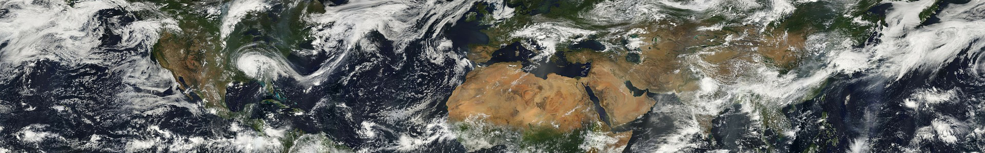
Hemispherical, optical sensors watch approximately 97% of the Earth’s surface continuously.

Narrow Field Sensor
A second optical sensor has a more narrow view, and is designed to monitor specific regions of up to 40,000 square kilometers. The sensor can be positioned to capture any new location within 15 seconds.
Live Earth Imaging Products

Digital Imagery
The Live Earth system is designed to deliver high-quality, full color imagery to your computer in 5 seconds or less. Compare this against visible and infrared imagery supplied by GOES.

Motion Imagery
“Continuous motion imagery” isn’t a video, but rather a series of images taken one second apart from each other. With motion imagery, you can track ships, planes and other objects continuously.

Night Time Imagery
Live Earth optical sensors are uniquely equipped to deliver discernable imagery of unlit objects at night under half to full moon lighting. Well-lit objects can be seen under any moonlight conditions.

24-Hour Surveillance
By providing instantaneous revisits of virtually the entire earth – or higher resolution of a region as large as Rhode Island – Live Earth provides you with the ability to monitor events continuously.

Real-time Alerts
Using next generation change and signatures detection algorithms, Live Earth will be the first Earth observation system to provide live alerts on events as far ranging as rocket launches, deforestation and oil spills.

Change Detection
Continuous motion imagery and 24-hour surveillance provide a foundation for the next generation of change detection software, improving predictive models, as well as other forms of imagery analytics.